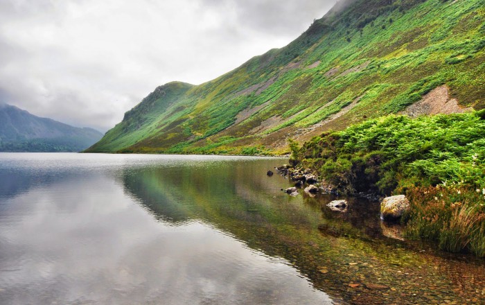
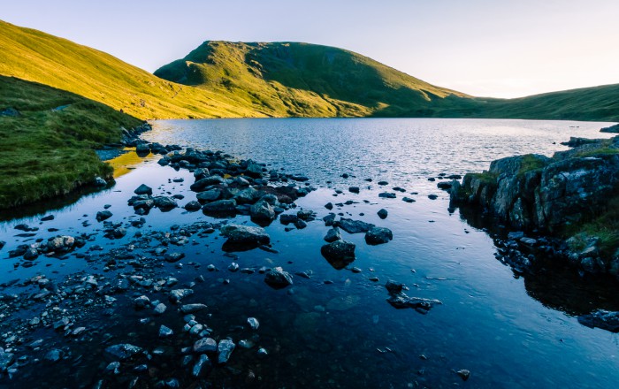
- Ennerdale Water – Photo by Danielle & Wayne Fenton
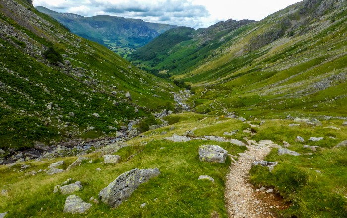
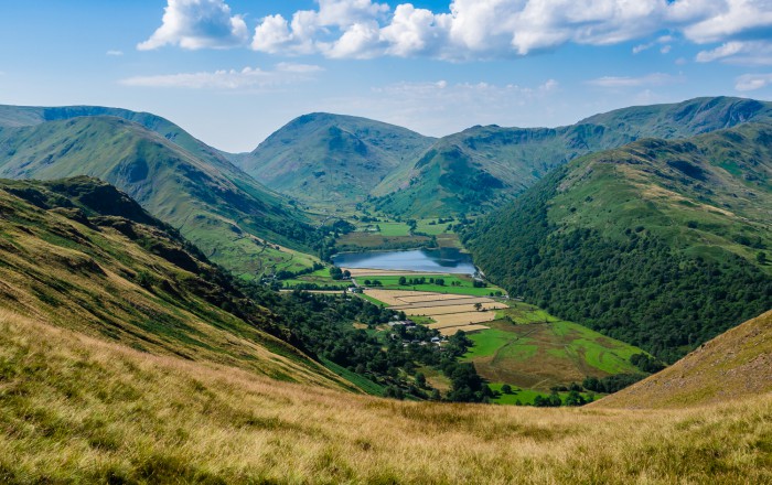
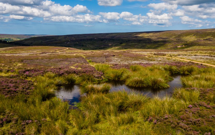
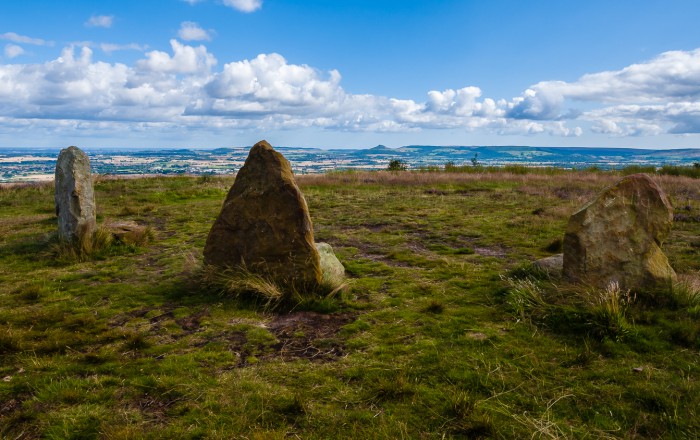
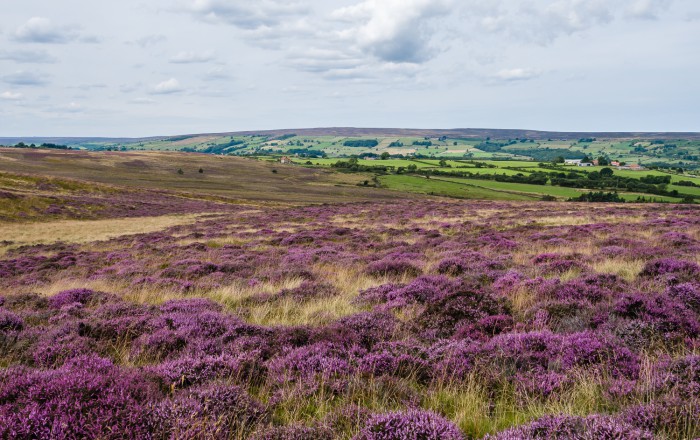
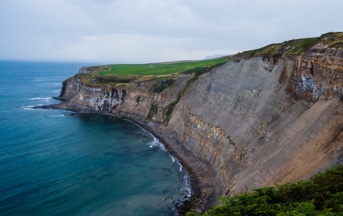
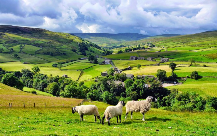
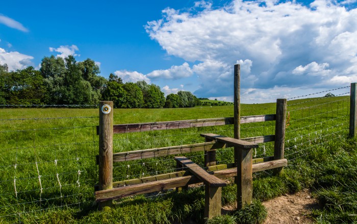
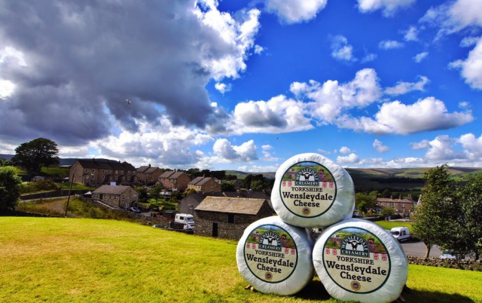
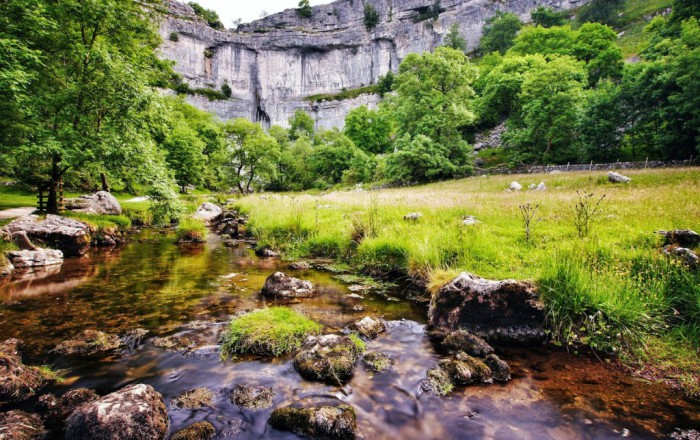
- Herdwick sheep in the Lake District – Photo by Danielle & Wayne Fenton
- View from Red Pike – Photo by Danielle & Wayne Fenton
- View from Scarth Gap – Photo by Danielle & Wayne Fenton
- Dub's Hut towards Honister Slate Mine – Photo by Danielle & Wayne Fenton
- Greenup Edge – Photo by Danielle & Wayne Fenton
- Grisedale Tarn – Photo by Danielle & Wayne Fenton
- Heading down to Honister Slate Mine – Photo by Danielle & Wayne Fenton
- Leaving Grisedale Tarn – Photo by Danielle & Wayne Fenton
- St Sunday Crag – Photo by Danielle & Wayne Fenton
- Ullswater and Patterdale – Photo by Danielle & Wayne Fenton
- Walking through Ambleside – Photo by Danielle & Wayne Fenton
- Brothers Water in the Hartsop Valley – Photo by Danielle & Wayne Fenton
- Angle Tarn – Photo by Danielle & Wayne Fenton
- Heading down to Haweswater – Photo by Danielle & Wayne Fenton
- Summit of Kidsty Pike – Photo by Danielle & Wayne Fenton
- Farmland near Sunbiggin – Photo by Danielle & Wayne Fenton
- Smardale Bridge – Photo by Danielle & Wayne Fenton
- Nine Standards Rigg – Photo by Danielle & Wayne Fenton
- Walking into Keld – Photo by Danielle & Wayne Fenton
- Farndale Moor – Photo by Danielle & Wayne Fenton
- The Lord Stones – Photo by Danielle & Wayne Fenton
- North Yorkshire Moors – Photo by Danielle & Wayne Fenton
- Coastal path near Robin Hood's Bay – Photo by Danielle & Wayne Fenton
_
Coast to Coast Walk
Across northern England from St Bees in Cumbria to the North Sea coast at Robin Hood’s Bay
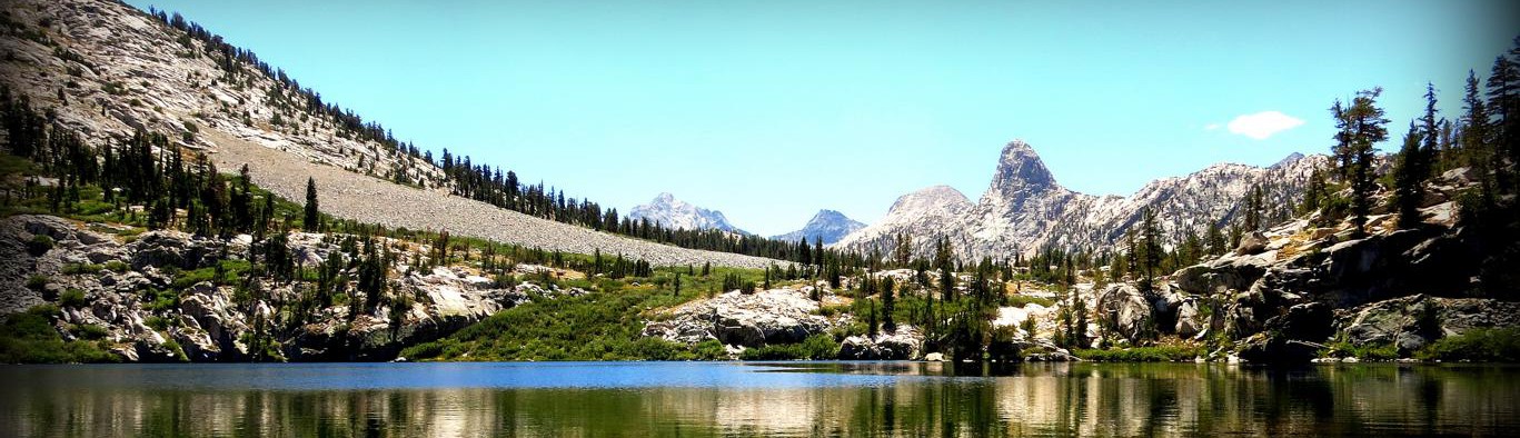
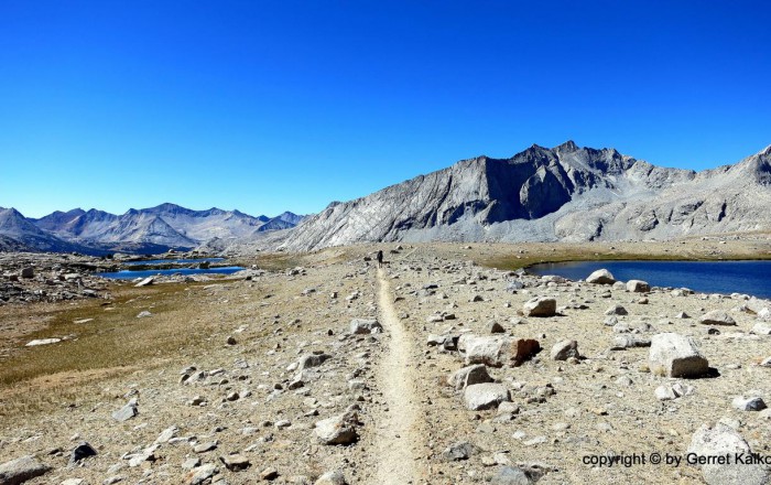
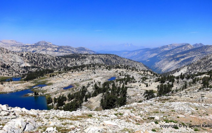
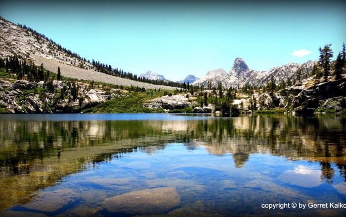
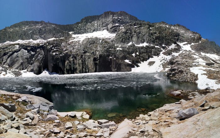
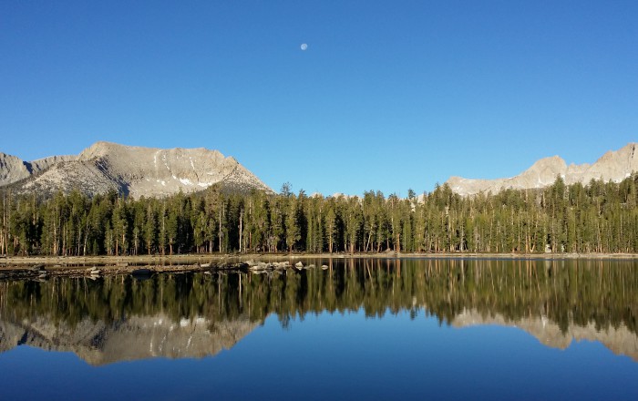
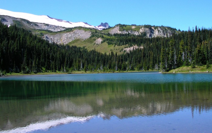
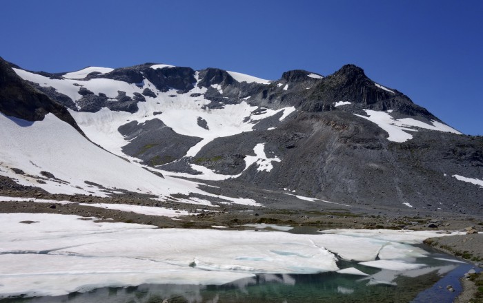
- Thousand Island Lake
- South of Mather Pass
- Looking South onto Sallie Keyes Lakes
- Dawn over Guitar and Hitchcock Lakes from Crest Trail
- Wanda Lake (11,426 ft)
- Crossing Piute Creek
- View from Forester Pass
- Pinchot Pass (12,139 ft)
- Approaching Silver Pass
- Crossing Shadow Creek
- Southern End of Lyell Canyon
- Lyell River Tuolumne Yosemite
- Trail near Cathedral Pass (9,700 ft)
- Campsite near Shepherd Pass Jct
- Dollar Lake
- Looking Back Over Evolution Valley
- Top of Mt. Whitney
- View from Mt. Whitney
- Farm on Four Notch Road – Photo by Plan & Go Hiking
- Trailhead #8 Four Notch – Photo by Plan & Go Hiking
- Pond near mile 58.5 – Photo by Plan & Go Hiking
- Big Woods Section – Photo by Plan & Go Hiking
- John Warren Road – Photo by Plan & Go Hiking
- Trailhead #10 Magnolia – Photo by Plan & Go Hiking
- Double Lake – Photo by Plan & Go Hiking
- Leaving Double Lake – Photo by Plan & Go Hiking
- Double Lake Branch – Photo by Plan & Go Hiking
- Big Creek Scenic Area – Photo by Plan & Go Hiking
- Winters Bayou Section – Photo by Plan & Go Hiking
- Final mile marker – Photo by Plan & Go Hiking
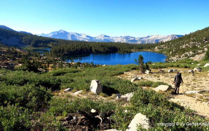
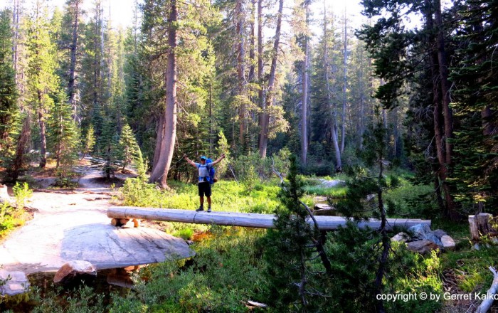
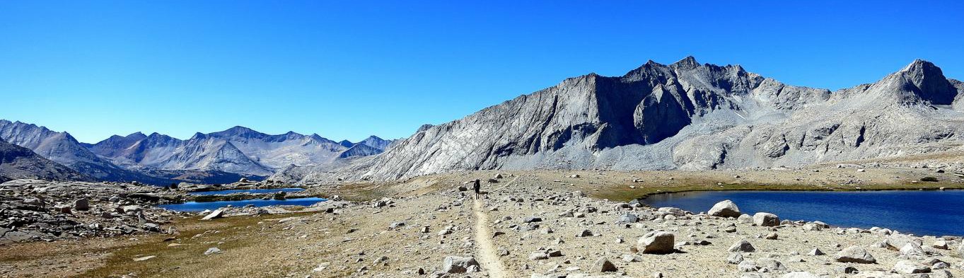
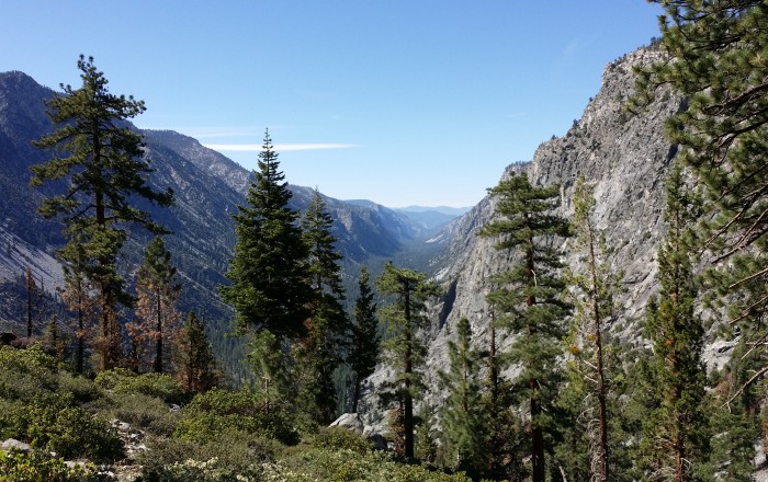
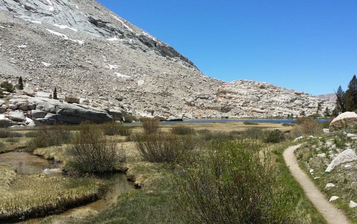
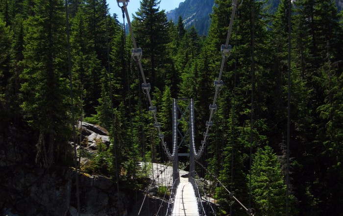
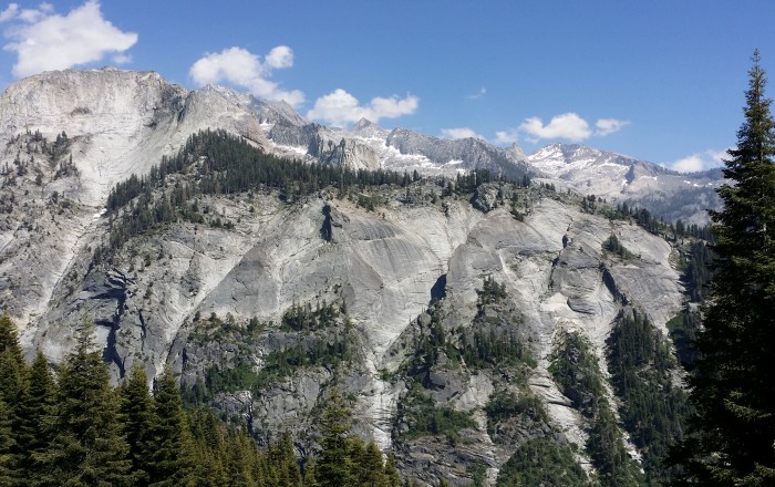
- Climbing towards Hamilton Lakes - Photo by Zebulon Wallace
- Sequoia National Park Trail with Overlook - Photo by Zebulon Wallace
- Big Arroyo - Photo by Zebulon Wallace
- Kaweah Gap - Photo by Zebulon Wallace
- Precipice Lake - Photo by Zebulon Wallace
- Rock Tunnel above Hamilton Lake - Photo by Zebulon Wallace
- Kern River Valley - Photo by Zebulon Wallace
- Kern Hot Spring - Photo by Zebulon Wallace
- Moraine Lake with Moon Reflection - Photo by Zebulon Wallace
- Guitar Lake Campsite - Photo by Zebulon Wallace
- Timberline Lake - Photo by Zebulon Wallace
- Backside of Whitney Summit - Photo by Zebulon Wallace
- Deer in Meadow - Photo by Zebulon Wallace
- Mt. Whitney Summit with Hut facing East - Photo by Zebulon Wallace
- Sunrise on Mt. Whitney - Photo by Zebulon Wallace
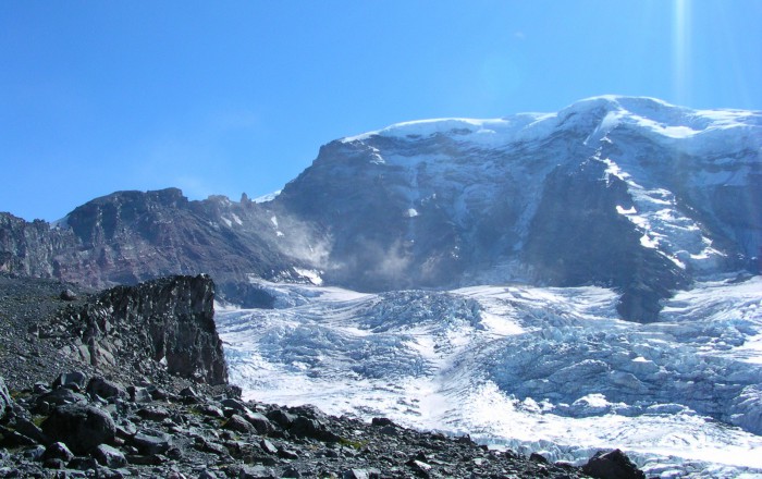
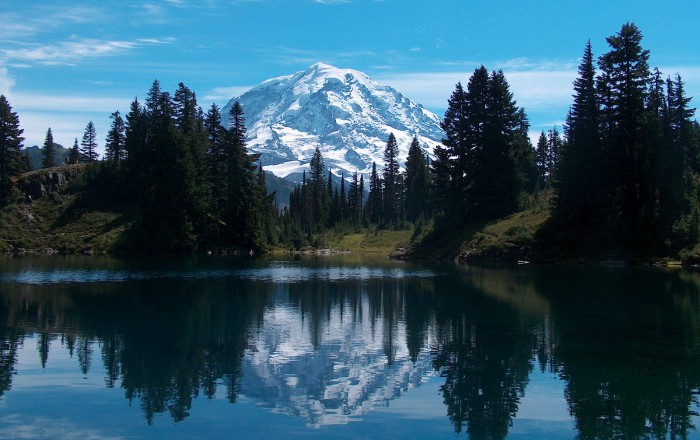
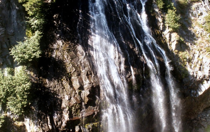
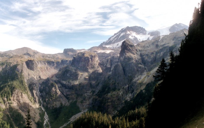
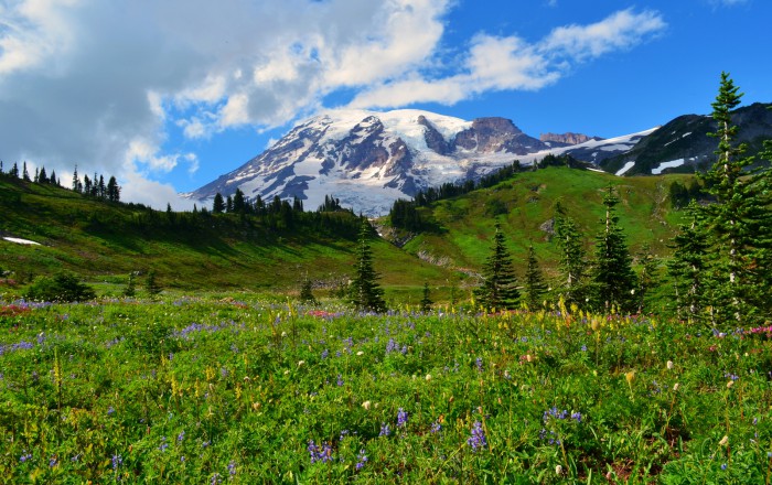
- Mount Rainier – Photo by Anupam_ts / CC BY-SA 2.0
- Mystic Lake – Photo by brewbooks / CC BY-SA 2.0
- Willis Wall and Carbon Glacier from Curtis Ridge – Photo by brewbooks / CC BY-SA 2.0
- Ohanapecosh Park – Photo by Henry C / CC BY-NC-SA 2.0
- White River – Photo by Brian Honohan / CC BY-NC-SA 2.0
- Spray Falls – Photo by Sean Munson / CC BY-NC-ND 2.0
- Between Summerland and Panhandle Gap – Photo by Sean Munson / CC BY-NC-ND 2.0
- Nisqually River – Photo by phoca2004 / CC BY-NC-ND 2.0
- Eunice Lake – Photo by Ryan / CC BY-ND 2.0
- Paradise River – Photo by Michael Hanscom / CC BY-NC-SA 2.0
- Suspension bridge over the Carbon River – Photo by Sean Munson / CC BY-NC-ND 2.0
- Narada Falls – Photo by Pat Leahy / CC BY-NC-ND 2.0
- Emerald Ridge towards Tahoma Glacier – Photo by Pat Leahy / CC BY-NC-ND 2.0
- South Mowich River – Photo by Pat Leahy / CC BY-NC-ND 2.0
- Puyallup Glacier – Photo by Pat Leahy / CC BY-NC-ND 2.0
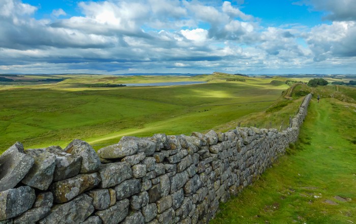
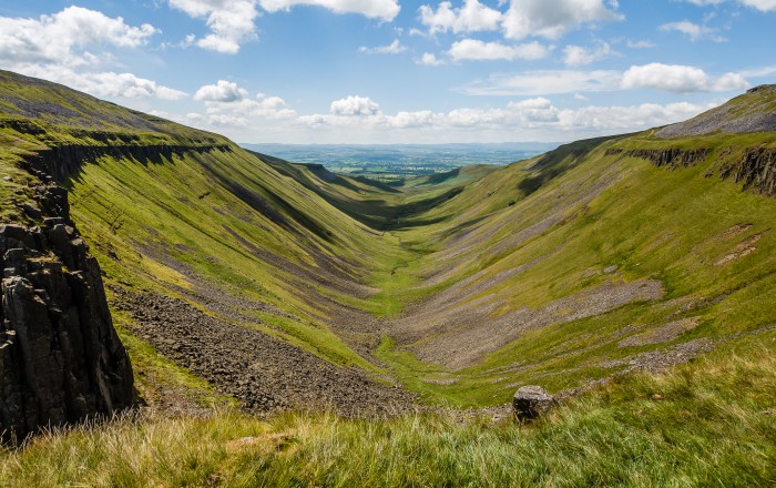
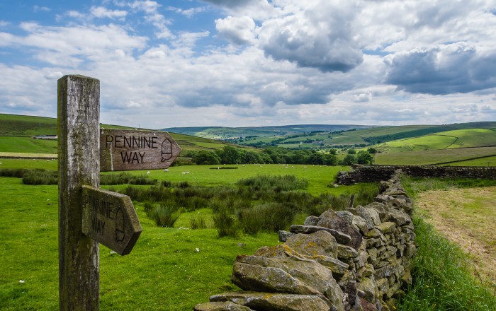
- Pennine Way Sign & Dry Stone Wall – Photo by Danielle & Wayne Fenton
- Wild Horses near High Cup Nick – Photo by Danielle & Wayne Fenton
- Lasting Impression of the Yorkshire Dales – Photo by Danielle & Wayne Fenton
- Typical Stile along the Route – Photo by Danielle & Wayne Fenton
- Giant Wensleydale Cheeses in Hawes – Photo by Danielle & Wayne Fenton
- Malham Cove – Photo by Danielle & Wayne Fenton
- Looking back to Pen-y-Ghent – Photo by Danielle & Wayne Fenton
- Looking down onto Lothersdale – Photo by Danielle & Wayne Fenton
- Beautiful House in the Country – Photo by Danielle & Wayne Fenton
- The Dalesman Cafe in Gargrave – Photo by Danielle & Wayne Fenton
- Walking along the Leeds & Liverpool Canal at East Marton – Photo by Danielle & Wayne Fenton
- Lovely arrival into Hawes Village – Photo by Danielle & Wayne Fenton
- Hills & Pastures – Photo by Danielle & Wayne Fenton
- Following Hadrians Wall – Photo by Danielle & Wayne Fenton
- Heading for Cross Fell – Photo by Danielle & Wayne Fenton
- Heading to Cauldron Snout – Photo by Danielle & Wayne Fenton
- High Cup Nick – Photo by Danielle & Wayne Fenton
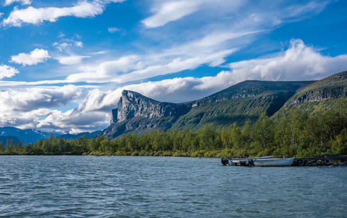
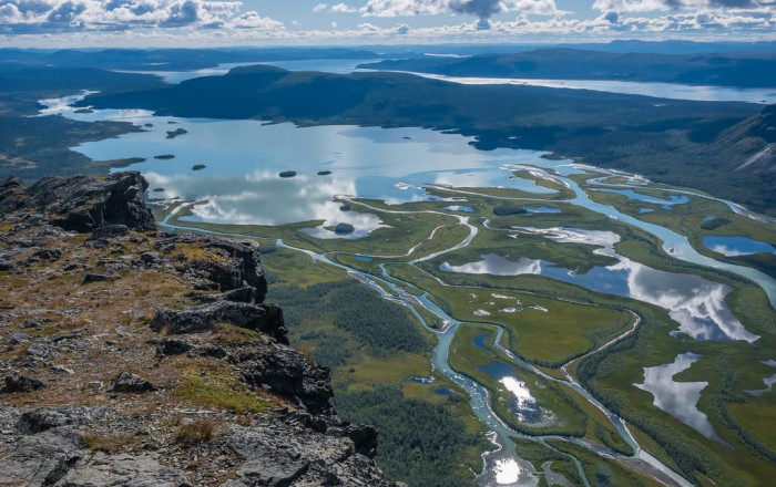
- View from Skierfe – Photo by Danielle & Wayne Fenton
- Typical wood-fired sauna along route – Photo by Danielle & Wayne Fenton
- Stony trail leads down to Lake Teusajaure – Photo by Danielle & Wayne Fenton
- Wooden boardwalks over boggy ground – Photo by Danielle & Wayne Fenton
- Traditional Lappish emergency shelter – Photo by Danielle & Wayne Fenton
- Wild camp spot – Photo by Danielle & Wayne Fenton
- Suspension bridge over Bartek River – Photo by Danielle & Wayne Fenton
- Spectacular north – Photo by Danielle & Wayne Fenton
- Scenic toilet location – Photo by Danielle & Wayne Fenton
- Row boats to cross Lake Laiture – Photo by Danielle & Wayne Fenton
- Alisvággi Valley – Photo by Danielle & Wayne Fenton
- Heading into the mountains – Photo by Danielle & Wayne Fenton
- Lake Laitaure – Photo by Danielle & Wayne Fenton
- Cooking dinner whilst watching sunset – Photo by Danielle & Wayne Fenton
- Lake Tärnasjö – Photo by Danielle & Wayne Fenton
- Detour off Kungsleden to Kebnekaise – Photo by Danielle & Wayne Fenton
- Chasing rainbows – Photo by Danielle & Wayne Fenton
- Kitchen & dining area inside Serve STF Hut – Photo by Danielle & Wayne Fenton
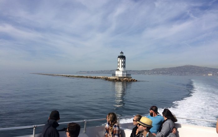
- Leaving San Pedro Ferry Terminal - Photo by Sam Ward
- Avalon Harbor - Photo by Sam Ward
- Prickly Pear and Oaks flanking the Path - Photo by Sam Ward
- Catalina Interior - Photo by Sam Ward
- Hiking along the exposed Ridgeline - Photo by Sam Ward
- Palos Verdes and San Gabriel Mountains - Photo by Sam Ward
- Airport in the Sky - Photo by Sam Ward
- Large Tile Map at the Catalina Airport - Photo by Sam Ward
- Bison Herd - Photo by Sam Ward
- Coastline between Little Harbor and Two Harbors - Photo by Sam Ward
- Shade Structure above Little Harbor - Photo by Sam Ward
- Approach to Little Harbor - Photo by Sam Ward
- Shark Harbor Campground - Photo by Sam Ward
- Starlight Beach (Western Terminus) - Photo by Sam Ward
- Parsons Landing from afar - Photo by Sam Ward
- Morning at Parsons Landing - Photo by Sam Ward
_
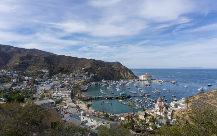
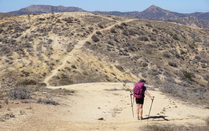
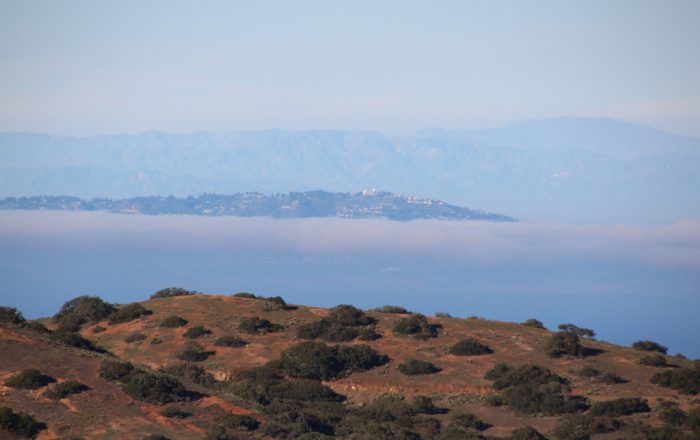
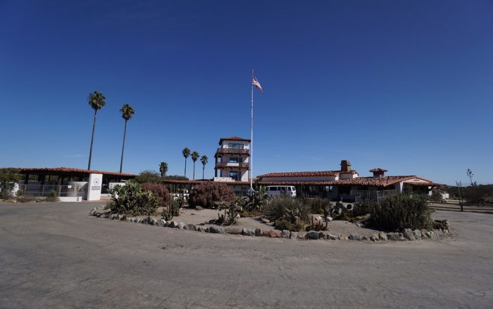
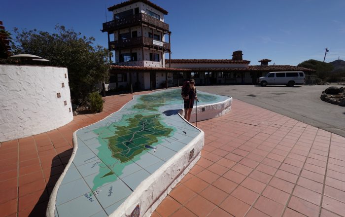
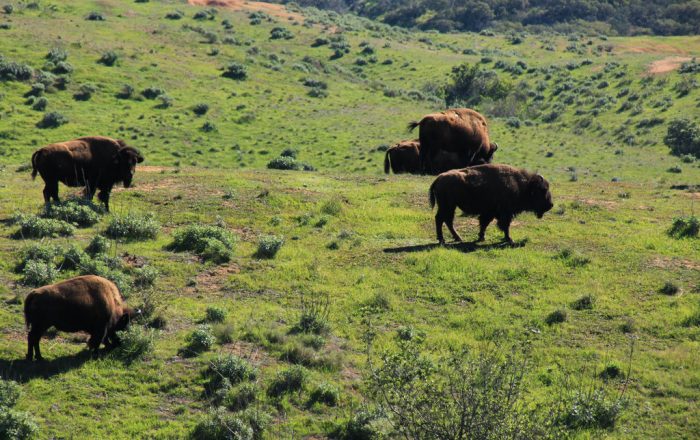
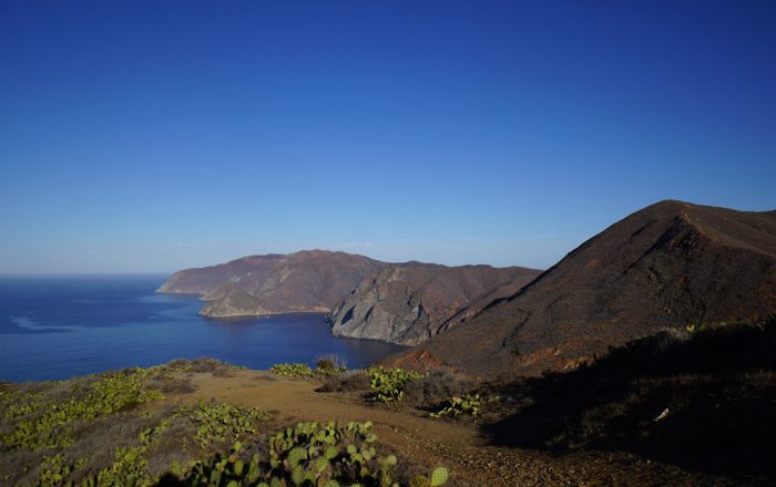
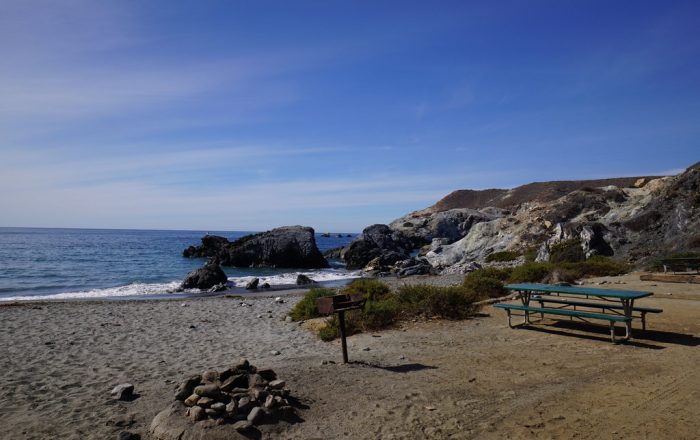
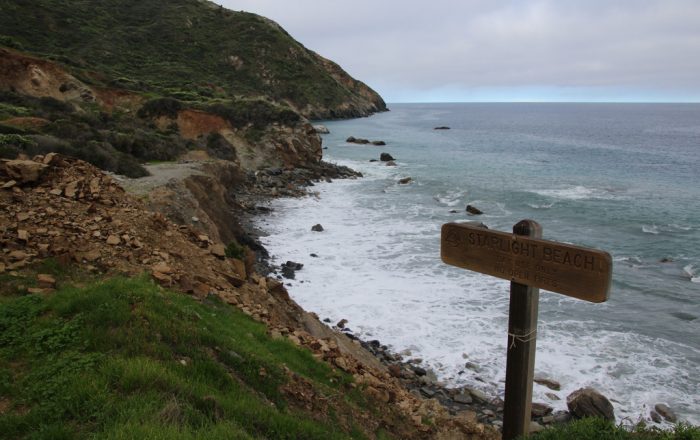
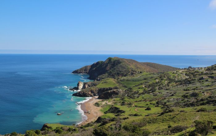
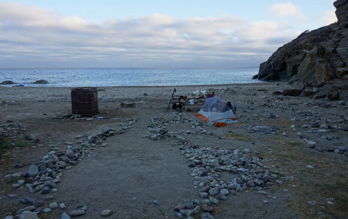
Trans-Catalina Trail
Traversing Southern California’s Santa Catalina Island just off the Coast of Los Angeles
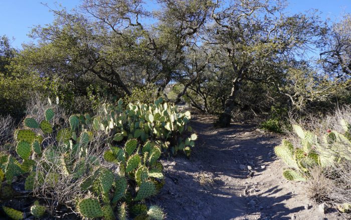
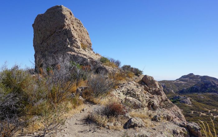
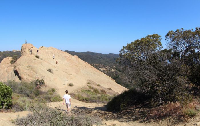
- Eagle Rock - Photo by Sam Ward
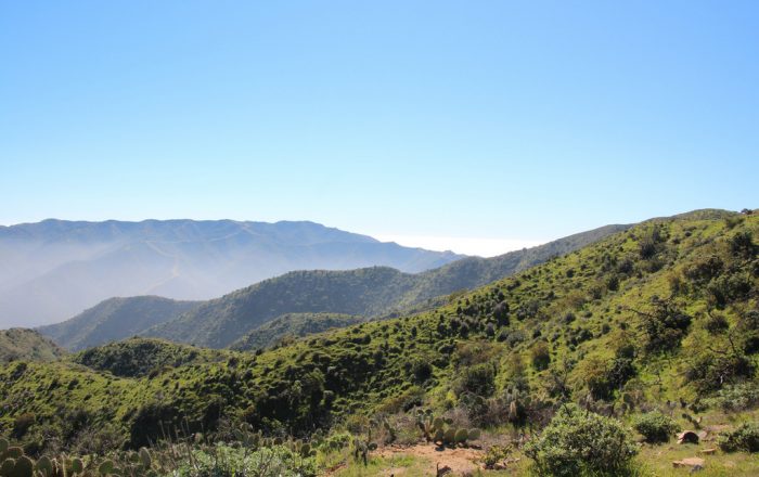
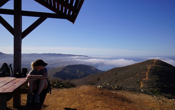
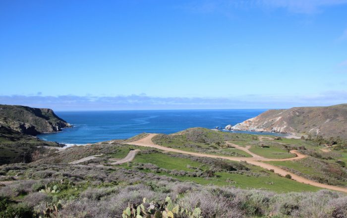
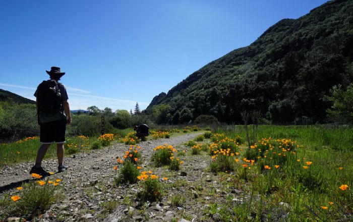
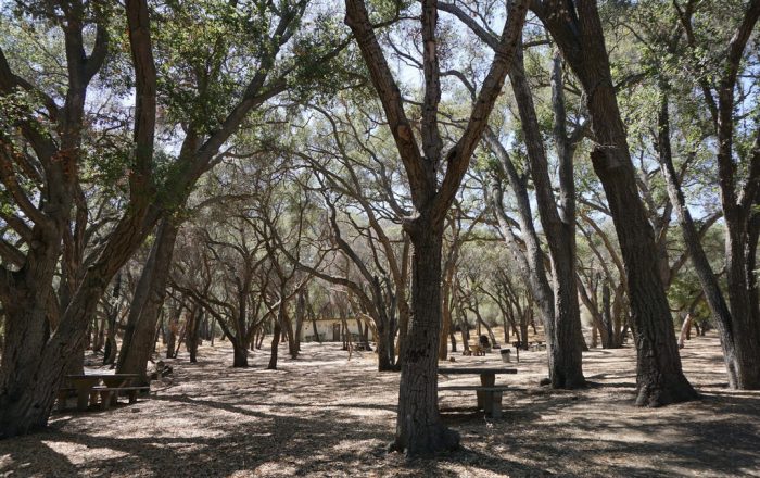
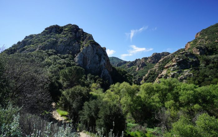
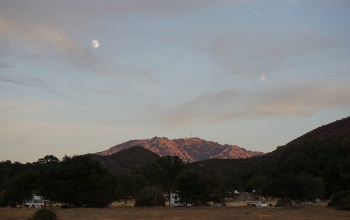
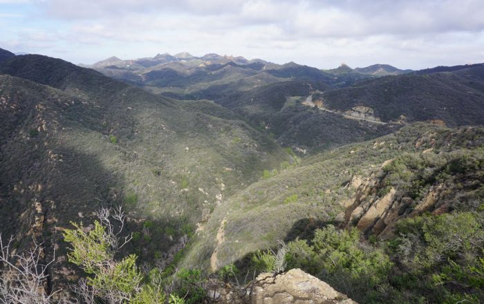
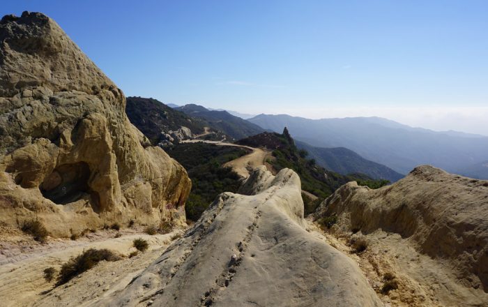
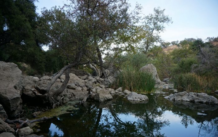
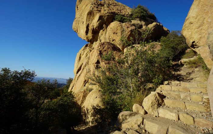
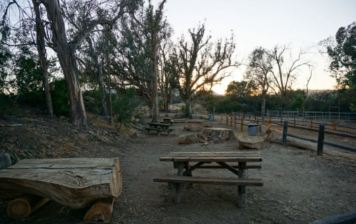
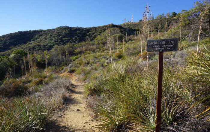
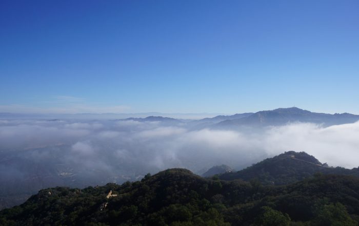
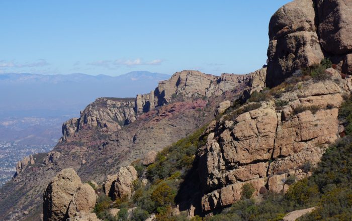
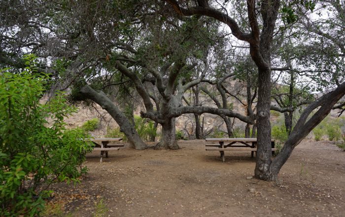
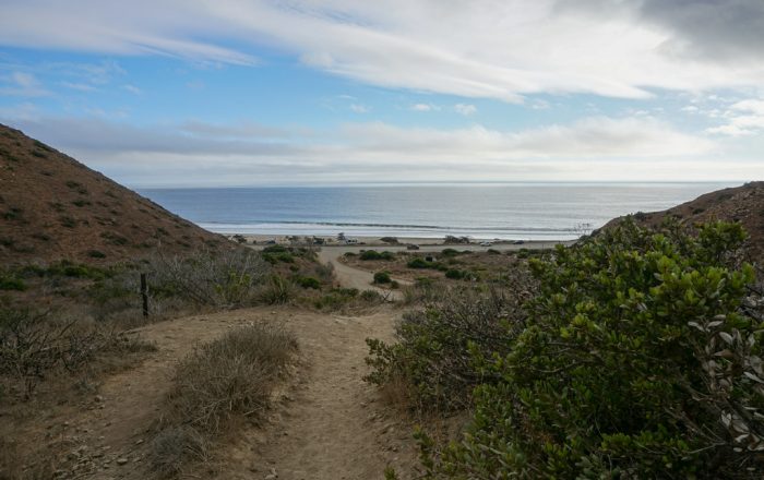
- Trailside Wildflowers - Photo by Sam Ward
- Tapia Park - Photo by Sam Ward
- Malibu Creek State Park - Photo by Sam Ward
- Moon over Malibu Creek State Park - Photo by Sam Ward
- Peak 1984 Zuma Canyon View - Photo by Sam Ward
- Sespe Formation - Photo by Sam Ward
- Rock Pools - Photo by Sam Ward
- Tri-Peak Summit Block and Sandstone Peak - Photo by Sam Ward
- Rock Formations around Saddle Peak - Photo by Sam Ward
- Musch Trail Camp - Photo by Sam Ward
- En Route to Latigo Canyon Trailhead - Photo by Sam Ward
- Low Clouds from McAuley Peak - Photo by Sam Ward
- Gates to Boney Mountain - Photo by Sam Ward
- La Jolla Valley Walk-in Campground - Photo by Sam Ward
- Walking to the Ocean - Photo by Sam Ward
_
Backbone Trail
Exploring Southern California’s Santa Monica Mountains between Will Rogers State Park and Point Mugu